informal-road-mapping
Network-conditioned detection of persistent, corridor-scale surface disturbance that may indicate unmapped informal roads in Mongolia.
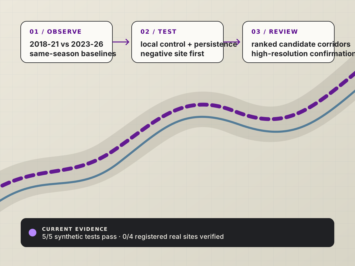
Result. Localized curved, braided, and broken corridors while rejecting blob and background confounds across 5/5 synthetic tests; real-site evidence remains gated on verification.
Catan Roads compares same-season multi-year Sentinel-2 baselines, normalizes disturbance against a local control annulus, and groups persistent pixels into candidate corridors. Because a single vehicle track is narrower than a 10 m Sentinel-2 pixel, the output is a ranked review queue for higher-resolution confirmation—not a road label.
| Category | Research |
|---|---|
| Timeline | 2026 - Present |
| Status | In Progress |
| Evidence | Synthetic extractor validated; real sites unverified |
| Role | Research framing, remote-sensing pipeline, falsification gate, synthetic extractor, and reproducibility tooling |
| Tools | Google Earth Engine, Python, Sentinel-2, OpenStreetMap |
| Links | RepositoryRegistered design |
problem
My contribution. Defined the resolvable corridor-scale problem, built the Earth Engine composite and batch-metric workflow, registered the development-versus-negative-control rule, and tested the ridge plus connected-component extractor on known-truth synthetic scenes.
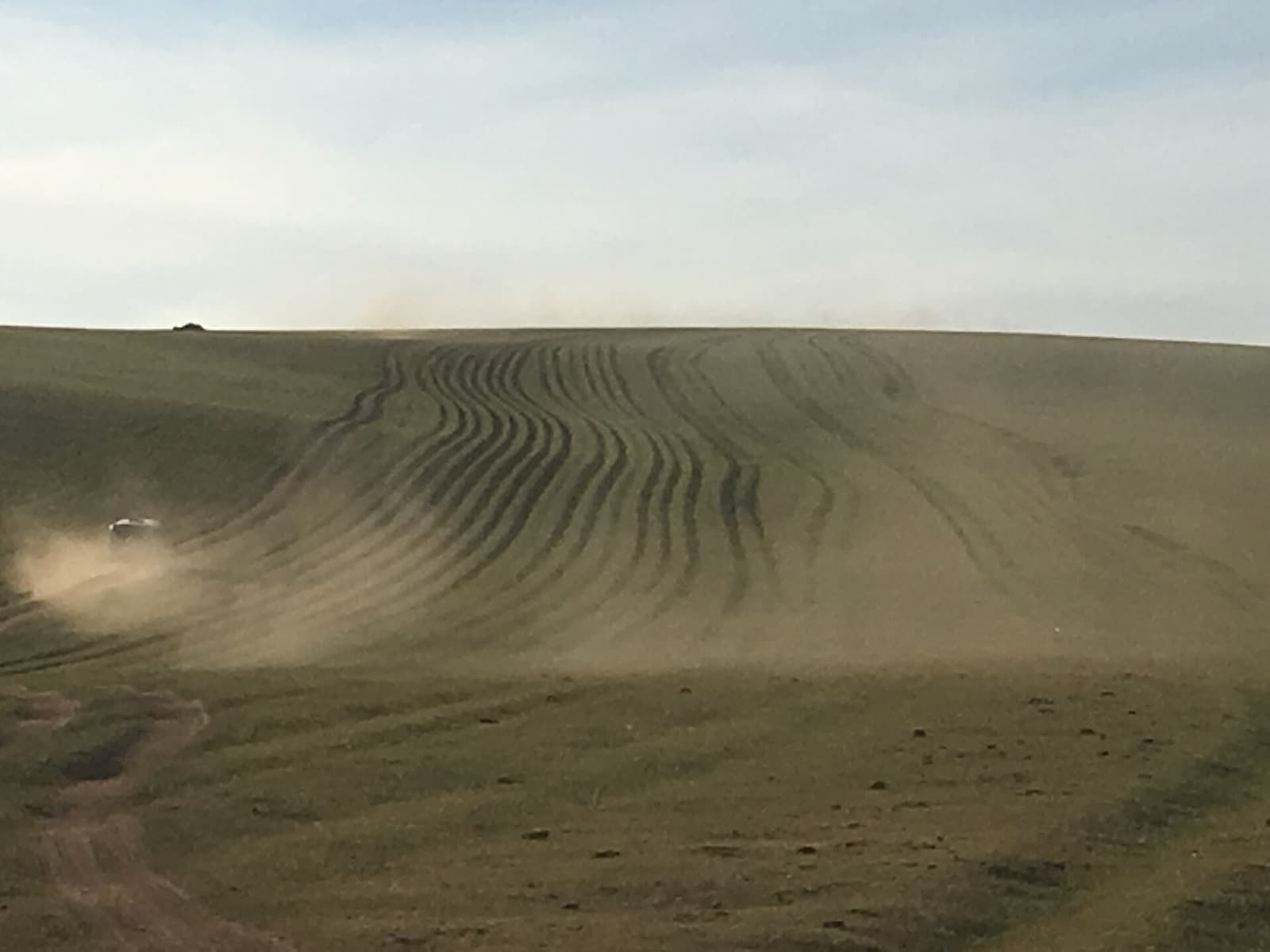
Mongolia's informal routes can widen, braid, migrate, and revegetate without appearing on a map. The engineering challenge is to find resolvable corridor-scale change without confusing vegetation cycles, water, agriculture, or settlements for roads.
constraints
- Treat individual 2.5-3 m vehicle tracks as sub-pixel at Sentinel-2's 10 m resolution.
- Compare 2018-2021 with 2023-2026 in the same season, with 2022 held as a buffer year.
- Require at least 90% analyzable coverage at every compared site.
- Freeze dated imagery provenance before any site can enter the registered gate.
design evolution
Iterations, issues, and fixes, recorded in the order they happened.
| Revision | Failure mode | Design change | Result |
|---|---|---|---|
| Resolvable target | A 10 m sensor cannot directly resolve a single 2.5-3 m track. | Targeted persistent braided corridors and network-scale disturbance instead of road pixels. | The claim matches the sensor's physical resolution. |
| Negative-control gate | Seasonality and land-cover change can resemble road disturbance. | Registered three development sites against a road-free negative control with a fixed coverage rule. | Unverified runs are labeled QA-only and cannot become results. |
| Extractor test | Connected bright pixels alone can favor round blobs and noise. | Combined ridge response, connected components, and corridor geometry on known-truth scenes. | 5/5 synthetic tests pass; real-raster extraction remains blocked. |
results
The synthetic suite checks curved, braided, and broken corridors plus a road-free scene, while the repository validator freezes the Earth Engine scale, site mirror, water-safe mask, output bands, and gate constants.
The registered real-imagery gate compares large-component fractions at three verified development sites with negative-01. Batch-exported CSV metrics—not the rendered map—are authoritative.
Scope note. All registered real-world sites remain unverified. The current evidence validates the extractor on synthetic scenes and does not establish road detection, traffic, or active-versus-abandoned classification in Mongolia.
lessons
- A method should target the physical resolution of its sensor, not the label one wishes it could see.
- Negative controls belong before extraction so a visually plausible map cannot overrule the quantitative gate.
- The useful product is a prioritized review queue connected to source evidence, not an unexplained heat map.
gallery